Visualizing Geographic Data
Warning
ODK Aggregate is no longer being updated. Please use ODK Central instead.
This guide helps the users to visualize the collected geodata uploaded on ODK Aggregate server using Google Earth.
Prerequisites
Make sure you have set up your ODK Aggregate server.
You should know how ODK Collect works.
You should be familiar with form designers like XLSForm to create your location based forms and upload it to ODK Aggregate server.
Google Earth
Google Earth is a virtual globe that accesses satellite and aerial imagery, and other geographic data over the internet to represent the Earth as a three-dimensional globe
Follow these steps to view your data using Google Earth:
Login to your ODK Aggregate server.
In the Submissions tab, under Filter Submissions, select the form you want to use and click on Export
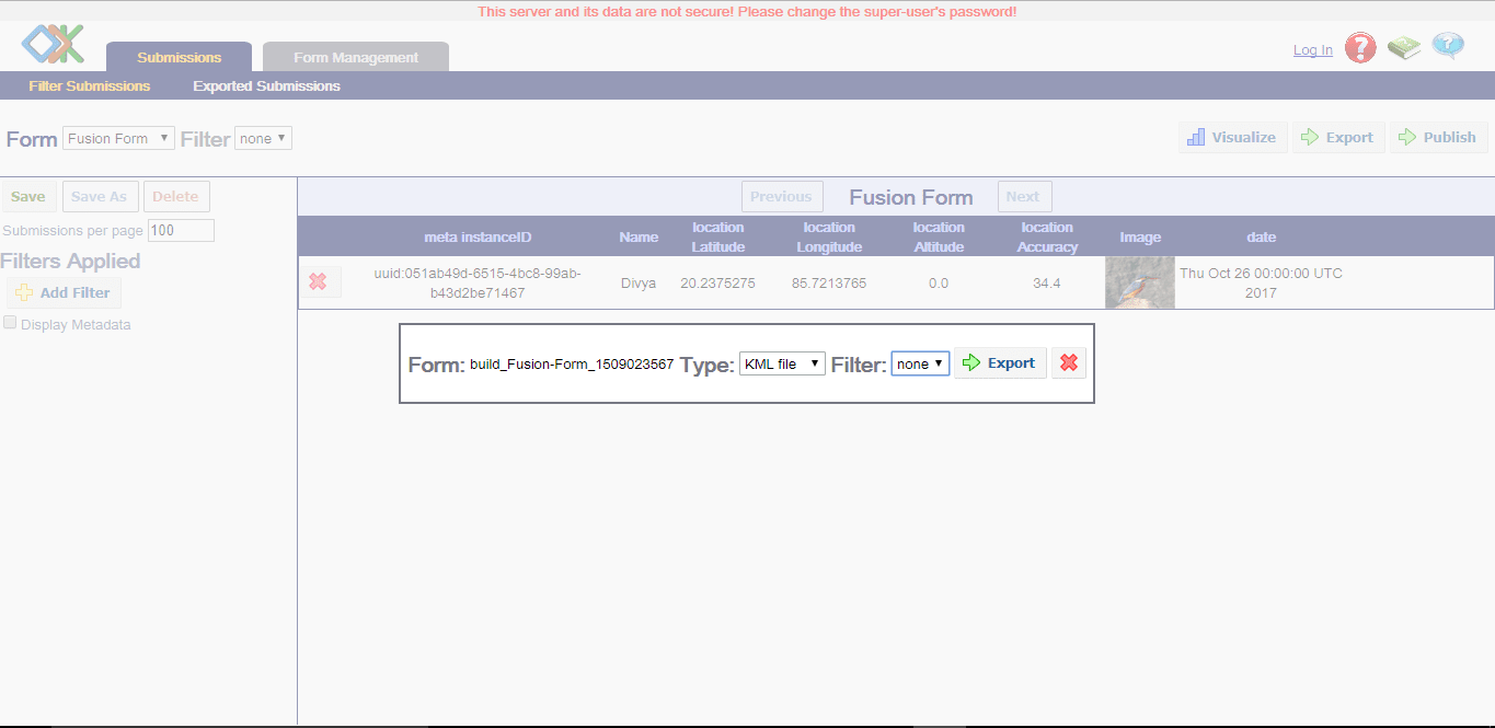
Choose the type as
KML fileand click on Export.
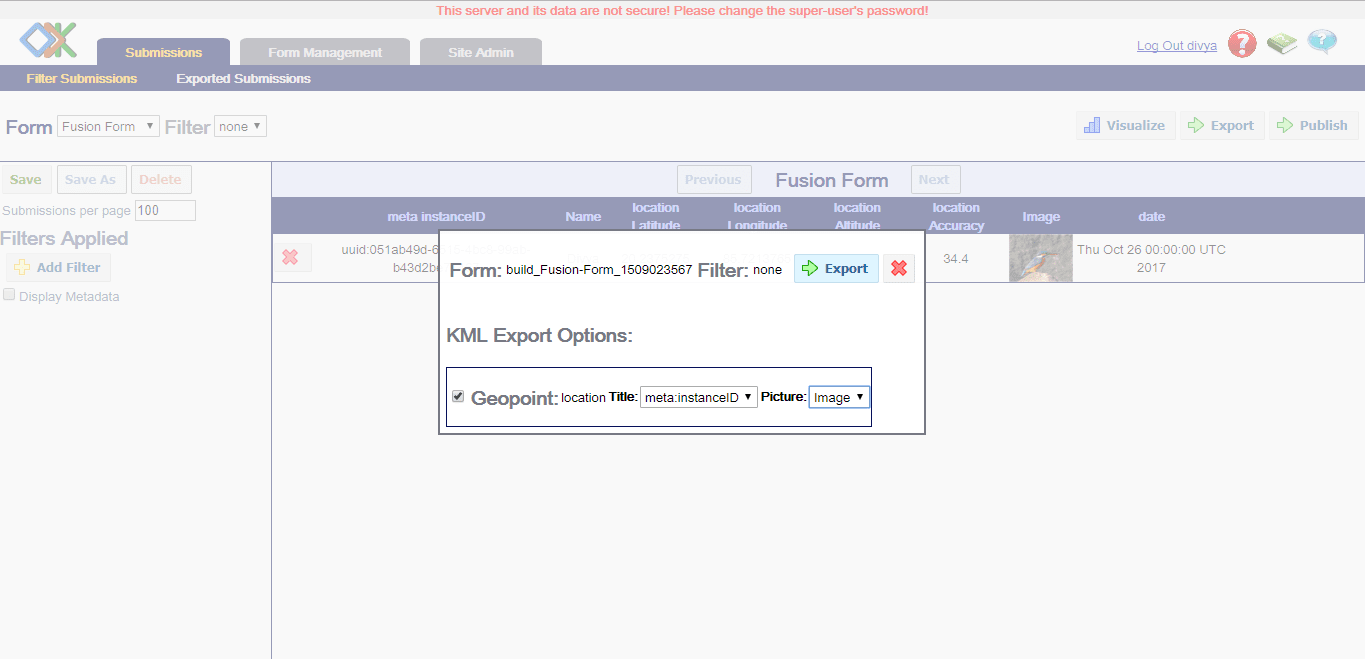
You don't need to change the default options, but you can select the according to your choice. Click on Export
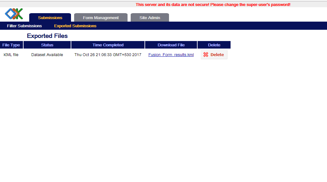
You will be redirected to Export Submissions page where you can download your kml file.
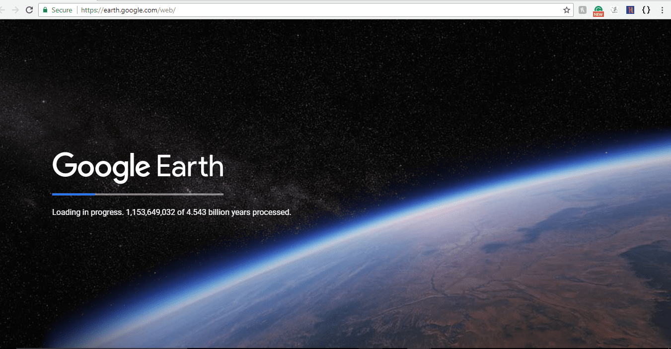
After downloading go to Google Earth website or you can download it from here. Wait for a while as Google Earth takes time to load.
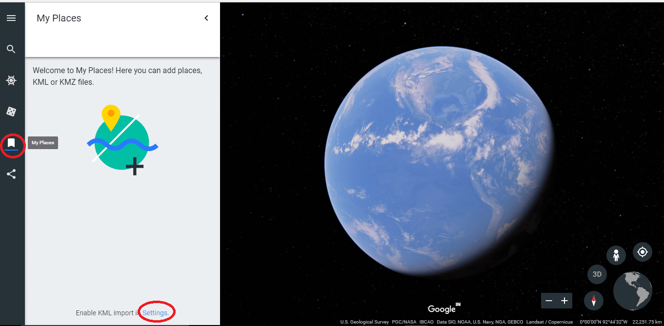
Click on
 and to enable KML import click on Settings.
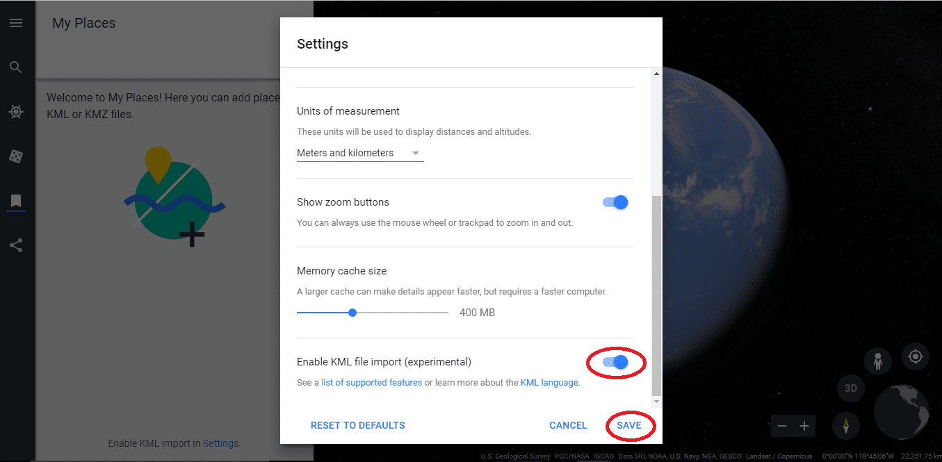
In the Settings window, enable KML file import and click on SAVE.
Click on IMPORT KML FILE and import the downloaded kml file.
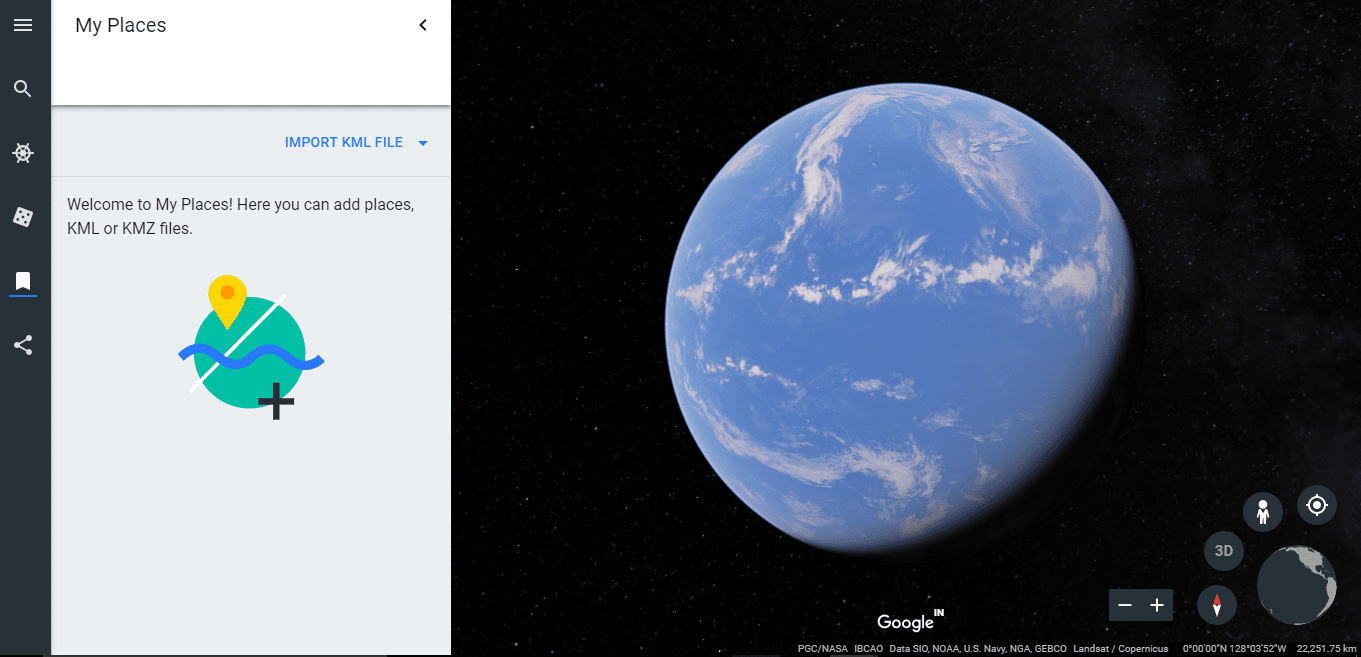
Now you will be able to see your data in an organized manner on Google Earth.

Tip
On Google Earth, you can choose your map style, add additional points, lines and polygons to add more information for the enhancement of map. You can also try out this tutorial on how to annotate Google Earth.